 |
380th Bomb
Group Association
|
MAPS
MAPS SHOWING OUR AIRFIELDS IN
THE PHILIPPINES AND OKINAWA
Map
1: How We Went to Mindoro
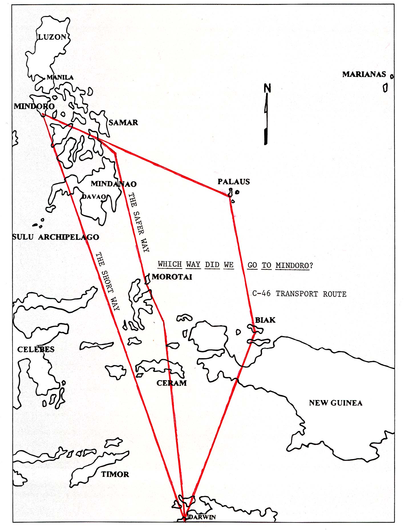
Map Source: Horton, Best in the Southwest.
Map
2:
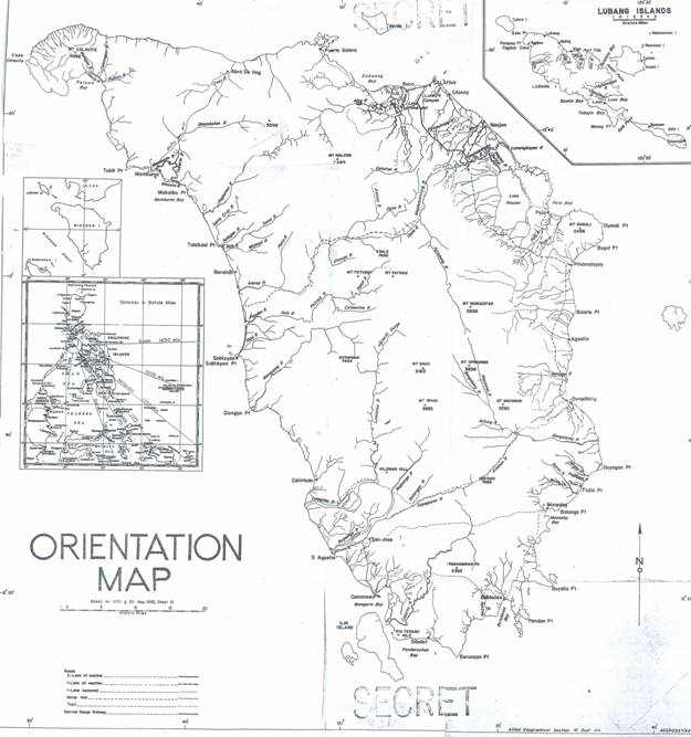
Orientation Map
Map
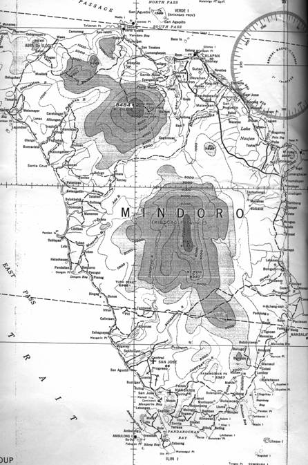
3: Mindoro Island Area
|
|
380th Bomb
Group Association
|
MAPS SHOWING OUR AIRFIELDS IN
THE PHILIPPINES AND OKINAWA
Map
1: How We Went to Mindoro
Map
2:
Orientation Map
Map
3: Mindoro Island Area
| LOCATION: | Latitude 12� 23� N., Longitude 121� 03� E. One of the islands of the Visayan Group, located in the central Philippines directly south of Luzon. |
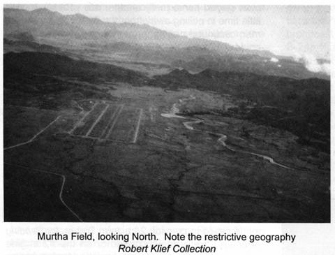
| TERRAIN: | The part of Mindoro Island on which Elmore, Hill, McGuire, and Murtha airdromes are located is a gently rolling plain on which are a few scattered palm trees and low shrubs. Numerous rice fields are located in the area. |
| LANDMARKS: | The airdrome area is located on the SW side of the island, between Mangarin Bay and the mouth of the Bugsanga River. |
| AIRDROMES: | Four airdromes: Elmore, Hill, McGuire, and Murtha, each with a single runway, located within a radius of 3 miles. |
Map
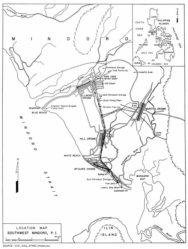
4: Overall Map Showing All Mindoro
Airfields
Map
5:
Murtha - Military Airdrome
| LOCATION: | Latitude 12� 25� N., Longitude 121� 06� E. About 5 miles directly north of Mangarin Bay. On west bank of Tabangan River |
| SIZE: | A single runway, 7000 ft x 100 ft, with a 500 ft overrun at each end. |
| SURFACE BEARINGS: | NE/SW. Approximately 30�00�/210�00� Magnetic. |
| SURFACE: | Steel mat. |
| ALTITUDE: | Estimated at approximately 30 ft above sea level. |
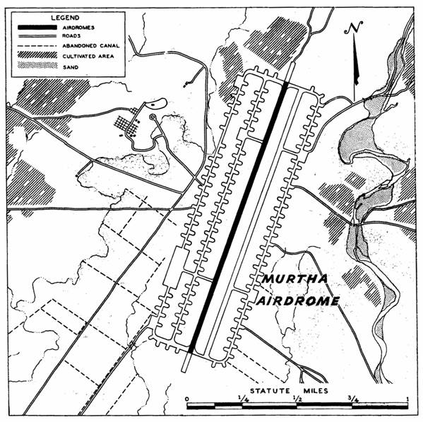
Map
6: Murtha Field
Source:
Horton, Best in the Southwest, p. 382.
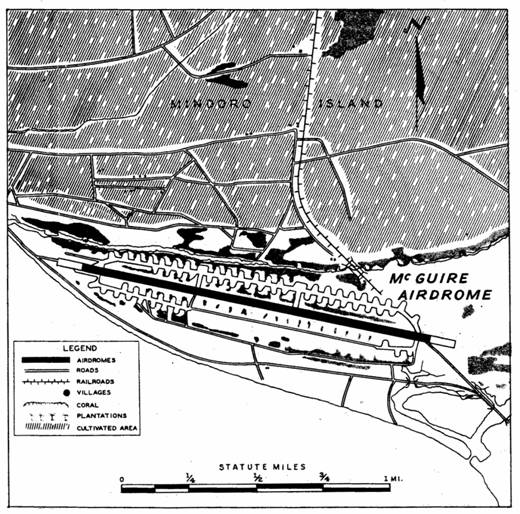
Map
7:
McGuire - Military Airdrome
| LOCATION: | Latitude 12� 22� N., Longitude 121� 03� E. On beach immediately northwest of Mangarin Bay. |
| SIZE: | A single runway, 7000 ft x 100 ft, with a 500 ft overrun at each end of the runway. |
| SURFACE BEARINGS: | E/W. 103�00�/283�00� Magnetic. |
| SURFACE: | Graded earth with 1 inch asphalt top. |
| ALTITUDE: | 18 ft above sea level. |
| PATTERN: | Left if landing to west; right if landing to east, depending on wind direction and instructions from tower - keep out to sea. |
| PATTERN ALTITUDE: | 500 to 1000 ft. |
| RON FACILITIES: | Accommodations for transient and emergency landed crews. |
| SERVICE FACILITIES: | Fuel and oil. Minor repairs only at present. |
| REMARKS: | Very soft shoulders. Make
normal approach but look out for Hill Field pattern which passes over middle of
McGuire runway. Taxiways are
unserviceable after heavy rain. Limited
parking space. Used mainly by the 90th Bomb Group. Used by 380th before Murtha ready. |
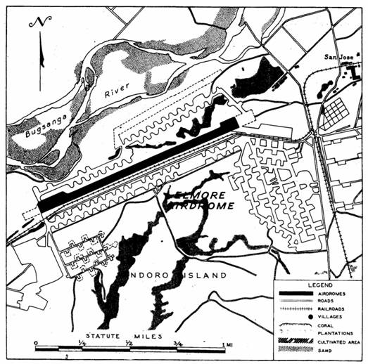
Map
8: Elmore - Military Airdrome
| LOCATION: | Latitude 12� 07� N., Longitude 120� E. This airdrome, which was formerly known as San Jose, lies 4.3 miles southwest of San Jose village. |
| SIZE: | A single runway, 6000 ft x 125 ft, with a 500 ft overrun at each end of the strip. |
| SURFACE BEARINGS: | ENE/WSW. 65�00�/235�00� Magnetic. |
| SURFACE: | Packed gravel. |
| ALTITUDE: | 50.44 ft above sea level. |
| PATTERN: | Left-hand. |
| PATTERN ALTITUDE: | 1500 ft. |
| OBSTRUCTIONS: | At east end of airdrome are buildings and trees which are approximately 30 ft high. Glideangle on NE end of runway is limited to 1:40 by these obstructions. |
| RON FACILITIES: | Accommodations for transient and emergency landed crews. |
| SERVICE FACILITIES: | Fuel and oil. Major repairs available. |
| REMARKS: | Subject to unserviceability due to weather. |
Map
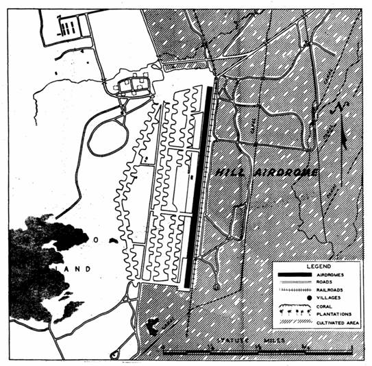
9: Hill - Military Airdrome
| LOCATION: | Latitude 12� 23� N., Longitude 121� 03� E. In the center of the airdrome area, southwest Mindoro approximately 1-1/2 mile north of McGuire airdrome and 3 miles south of Elmore airdrome. |
| SIZE: | A single runway, 5750 ft x 100 ft. |
| SURFACE BEARINGS: | N/S8�00�/188�00� Magnetic. |
| SURFACE: | Packed earth. |
| ALTITUDE: | 22 ft above sea level. |
| PATTERN: | Left-hand. |
| PATTERN ALTITUDE: | 1500 ft. |
| RON FACILITIES: | Very limited, but transportation available to transient camp. |
| SERVICE FACILITIES: | Fuel and oil. Light maintenance and minor repairs available. |
| REMARKS: | Runway is operational in dry weather only and is serviceable for limited operations to fighters and troop carriers. Taxiways are very soft; heavy airplanes should land at Elmore or McGuire. |
Map
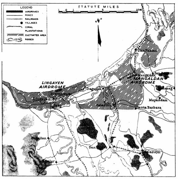
10: Lingayen Area
| LOCATION: | Latitude 16� 02� N., Longitude 120� 20� E. Includes the area immediately south of and bordering Lingayen Gulf, West Central Luzon. |
| TERRAIN: | The terrain in the vicinity of the Lingayen airdromes is flat, low, and swampy. Numerous fish ponds and waterways are in the area. The area composes the northern part of the Central Luzon Plain. |
| LANDMARKS: | The towns of Lingayen and Dagupan and the village of Mangaldan are all within 3 miles of the southern shore of Lingayen Gulf. Lingayen and Mangaldan are approximately 12 miles apart with Dagupan located midway between them. |
| AIRDROMES: | Two airdromes: Lingayen and Mangalden, each with a single runway. |
Map
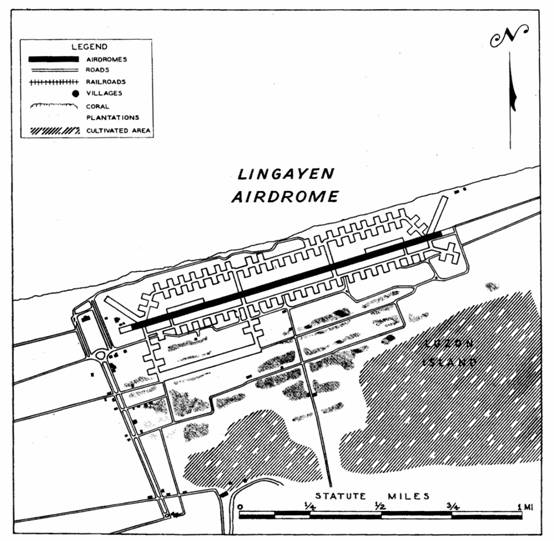
11: Lingayen - Military Airdrome
| LOCATION: | Latitude 16� 2� N., Longitude 1210� 15� E. On Lingayen Gulf, north of Lingayen town, and east of Dagupan. |
| SIZE: | A single runway, 7000 ft x 100 ft, with a 500 ft overrun at each end. |
| SURFACE BEARINGS: | ENE/WSW. 73�00�/253�00� Magnetic. |
| SURFACE: | Steel mat. |
| ALTITUDE: | Approximately 7 ft above sea level. |
| PATTERN: | Tower controlled. |
| PATTERN ALTITUDE: | Usually 1000 ft to 1500 ft. Tower controlled. |
| OBSTRUCTIONS: | There are no obstructions but heavy airplanes usually take off to the east to avoid camp at west end of runway. |
| RON FACILITIES: | Accommodations for transient and emergency landed crews. |
| SERVICE FACILITIES: | Fuel and oil. Major repairs available. |
| REMARKS: | The runway, which is very wavy, usually has a cross wind from the gulf. |
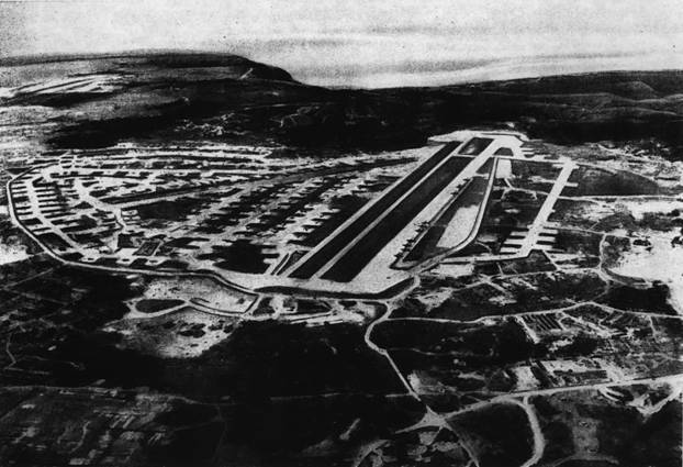
YONTAN
THE OKINAWA AIRFIELD
Map
12: Yontan Airfield on Okinawa
Original Japanese Field
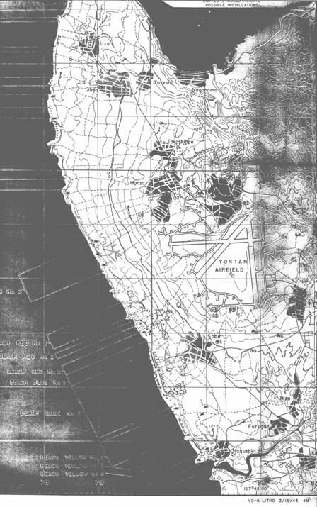
Map
13: Yontan Airdrome on Okinawa
As Expanded by the Americans
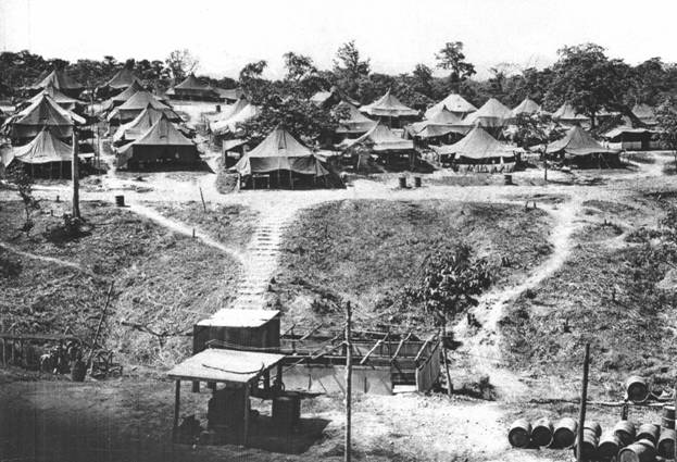
THE CAMPSITE AT MINDORO
Map
14: Aerial View of Mindoro Camp Area
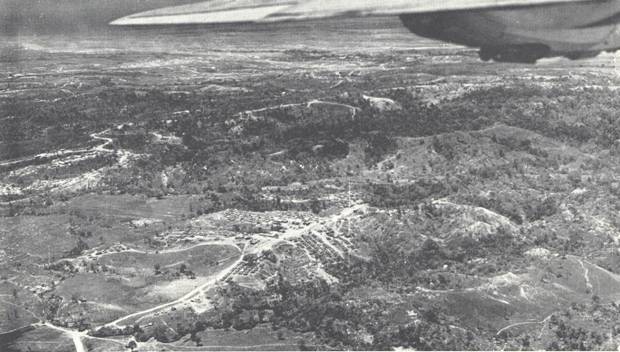
Source: Fain et al., The Flying Circus, 380th Bomb Group, p. 106.
Map
15: General View of 530th,
528th and 531st Areas
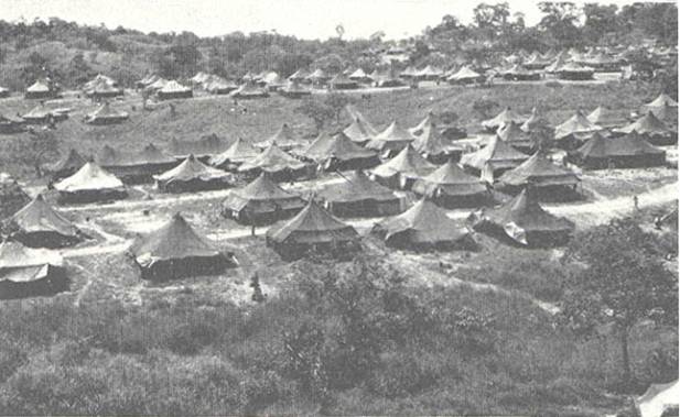
Source: Fain et al., The Flying Circus, 380th Bomb Group, p. 107.
Map
16: Show Area and 530th
Buildings from Snob Hill
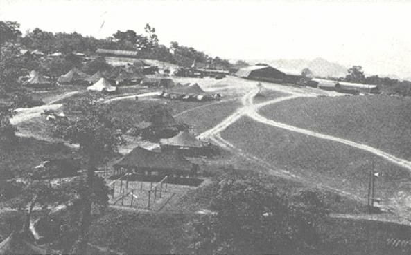
Source: Fain et al., The Flying Circus, 380th Bomb Group, p. 107.
Map
17: 529th, Enlisted
Men's Quarters, Murtha Field,
San Jose, Mindoro, 1945
Source:
Joe Maloney Collection.
Map
18: 529th, Shower Area,
Murtha Field, San Jose, Mindoro, 1945
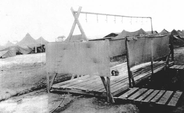
Source:
Joe Maloney Collection.
MISSION MAPS
Map
19: Missions Flown in The
Philippines, February 1945
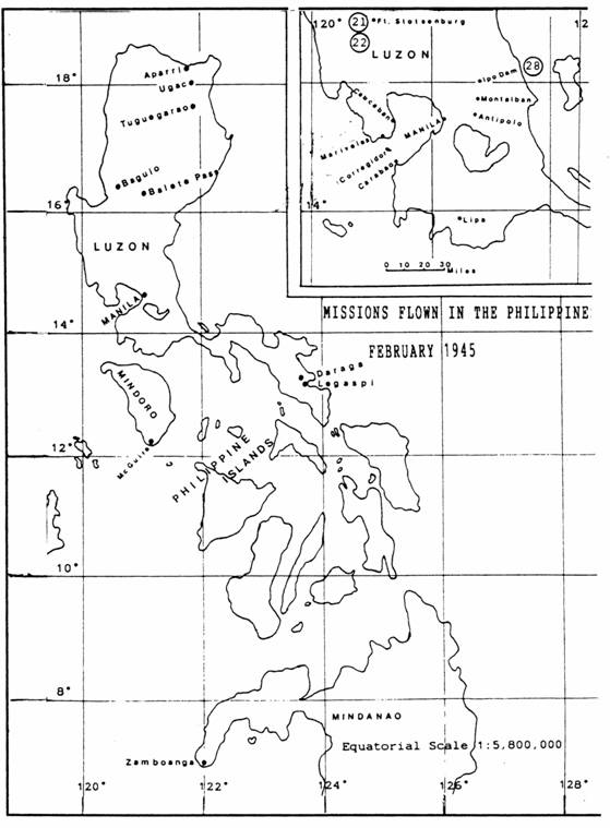
Turner Publishing, 1994, p. 161.
Map
20: Missions Flown to Formosa,
February 1945
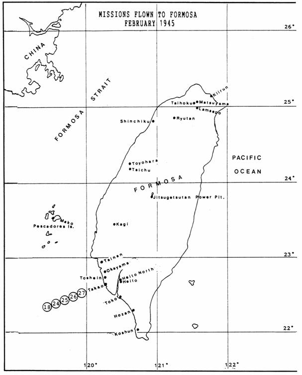
Turner Publishing, 1994, p. 161.
Map
21: Missions Flown in The
Philippines, March 1945
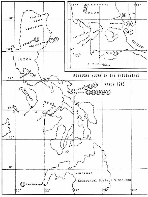
Source:
Adapted from Wiley O. Woods, Jr.,
Legacy of the 90th Bombardment Group,
Turner Publishing, 1994, p. 161.
Map
22: Missions Flown to Formosa, March
1945
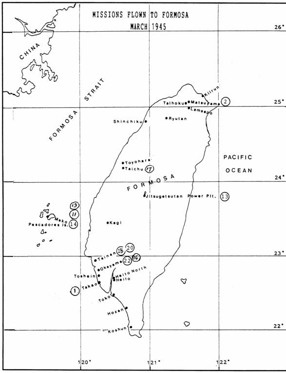
Source:
Adapted from Wiley O. Woods, Jr.,
Legacy of the 90th Bombardment Group,
Turner Publishing, 1994, p. 161.
Map
23: Missions Flown to Formosa, April
1945
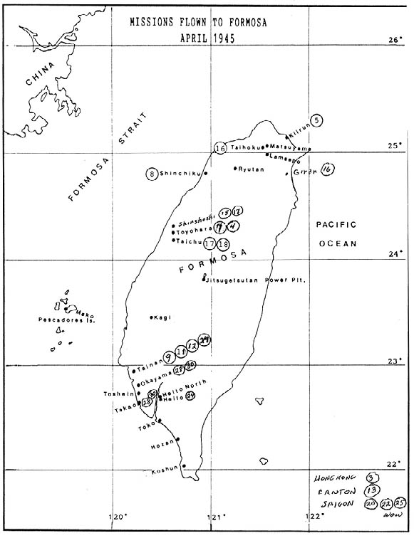
Source:
Adapted from Wiley O. Woods, Jr.,
Legacy of the 90th Bombardment Group,
Turner Publishing, 1994, p. 161.
Map
24: Missions Flown in The
Philippines, April 1945
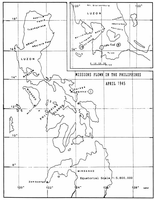
Source:
Adapted from Wiley O. Woods, Jr.,
Legacy of the 90th Bombardment Group,
Turner Publishing, 1994, p. 161.
Map
25: Missions Flown to Formosa, May
1945
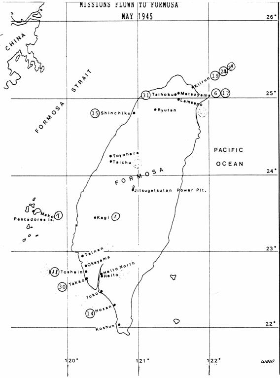
Turner Publishing, 1994, p. 161.
Map
26: Missions Flown in The
Philippines, May 1945
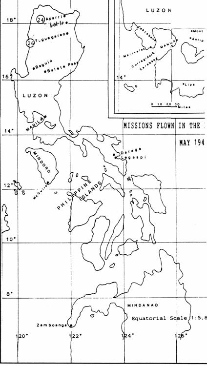
Source:
Adapted from Wiley O. Woods, Jr.,
Legacy of the 90th Bombardment Group,
Turner Publishing, 1994, p. 161.
Map
27: Missions Flown to Formosa, June
1945
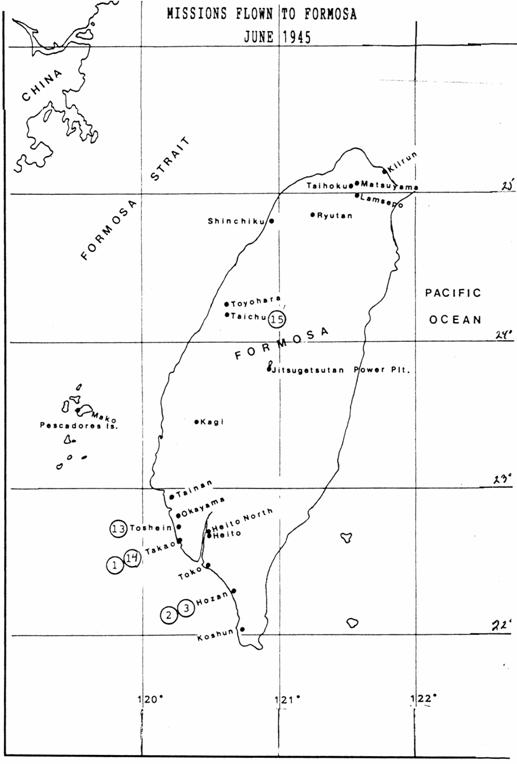
Source:
Adapted from Wiley O. Woods, Jr.,
Legacy of the 90th Bombardment Group,
Turner Publishing, 1994, p. 161.
Map
28: Missions Flown to Formosa, July
1945
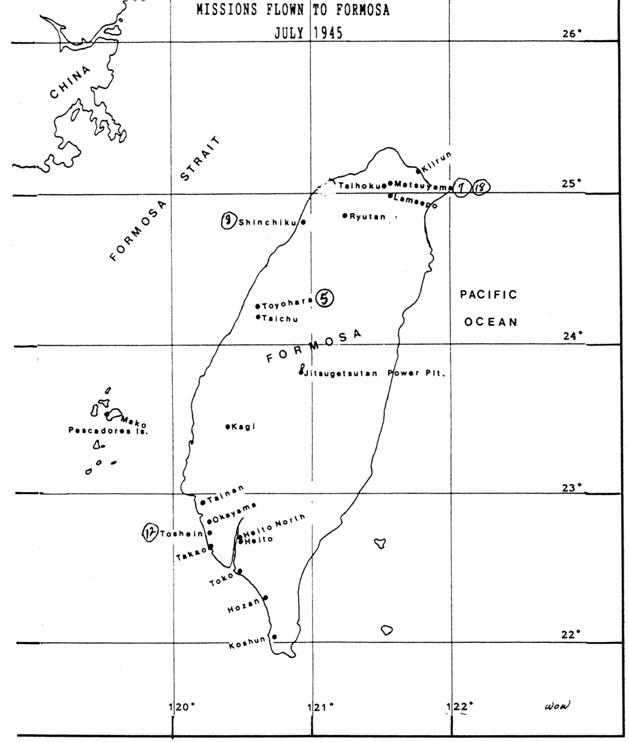
Source:
Adapted from Wiley O. Woods, Jr.,
Legacy of the 90th Bombardment Group,
Turner Publishing, 1994, p. 161.
Map
29: Missions Flown to China, French
Indo-China & Borneo, 1945
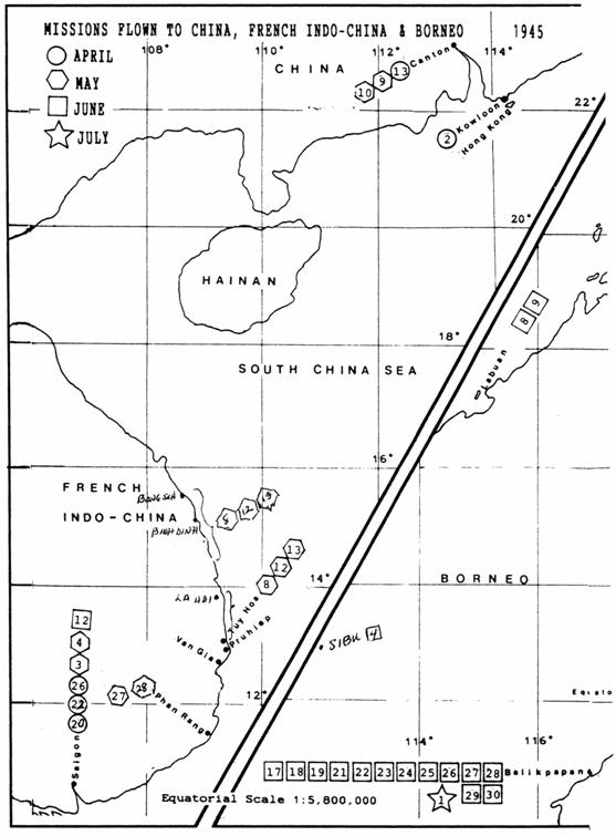
Source:
Adapted from Wiley O. Woods, Jr.,
Legacy of the 90th Bombardment Group,
Turner Publishing, 1994, p. 161.
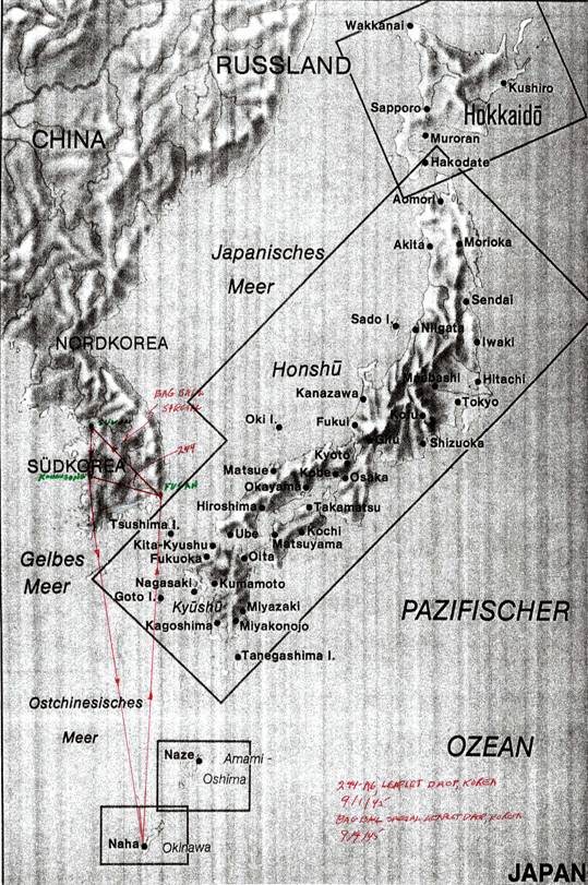
Map
30: Leaflet Drops, Korea, September
1945
Return to Part VI - Table of Contents |
Return to Part VI - Introduction |